By Anna Makushkina
Geologists were fascinated by the enigmatic origin of the lakes in Tasmania throughout the 19th century. The glacial origin of these lakes was first recognized by Officer in 1895. Nowadays everyone accepts the occurrence of several glaciations and its leading role in shaping the Tasmanian topography including the formation of multiple lakes and moraine deposits, which have been dated from Quaternary to Neoproterozoic in age (Hoffman, Li, 2009).
Last Glacial Maximum event (the global LGM; 21±3 ka) had a significant effect on the Tasmanian topography and surficial geology of Australia. Glaciers in the Tasmanian highlands occupied ∼450 cirques and formed two ice caps in western Tasmania (Fig.1). The term LGM is referring to the maximum global ice volume during the last glacial cycle with evidence from marine isotope record and global eustatic level (Ehlers et al., 2007). The LGM in Tasmania is often assumed to have occurred during the period that correlated with Late Wisconsin glaciation of North America (Colhoun et al., 1996). Ages of the LGM in Tasmania differ: age of 22±2 ka was obtained using 10Be for the Dove Valley (Colhoun, 2004), while another study (Barrows et al., 2002) suggests the age of 17.3±1.1 ka (using 10Be) and 20.1±1.9 ka (36Cl ages). Younger ages of terminal moraine deposits (Lake Dove terminal moraine deposits 17.4±1.2 ka (Barrows et al., 2002)) provide evidence for a rather quick deglaciation (2000-3000 years at most after the glacial maximum).
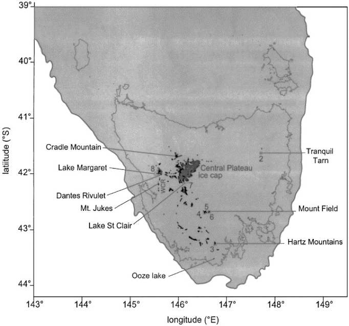
Fig. 1. Regional map showing the extent of glaciation in Tasmania during the LGM and locations sampled for exposure dating (numbered sites refer to figure numbers). Small circles are positions of cirques that were probably active during the LGM. Dark gray areas are maximum ice limits. The light gray area is bounded by the coastline during the LGM, defined by the −120 m contour. WCR=West Coast Range (Barrows et al., 2002).
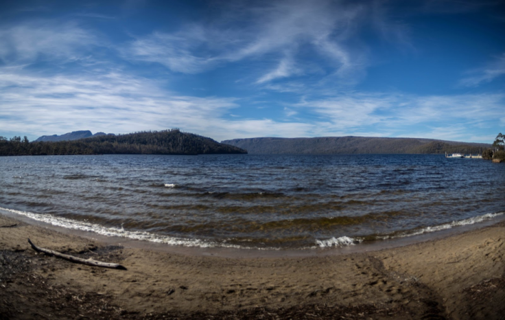
Fig. 2. Lake St. Clair – Australia’s deepest lake with the maximum depth of 167 meters. Aboriginal people called the lake Leeawuleena (“sleeping water”). Moraines, where debris is forced to the margins of the glacier, run along part of the length of the lake. (Photo credit: Ilya Bobrovskiy)
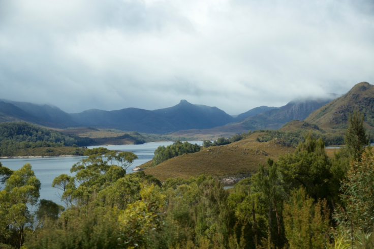
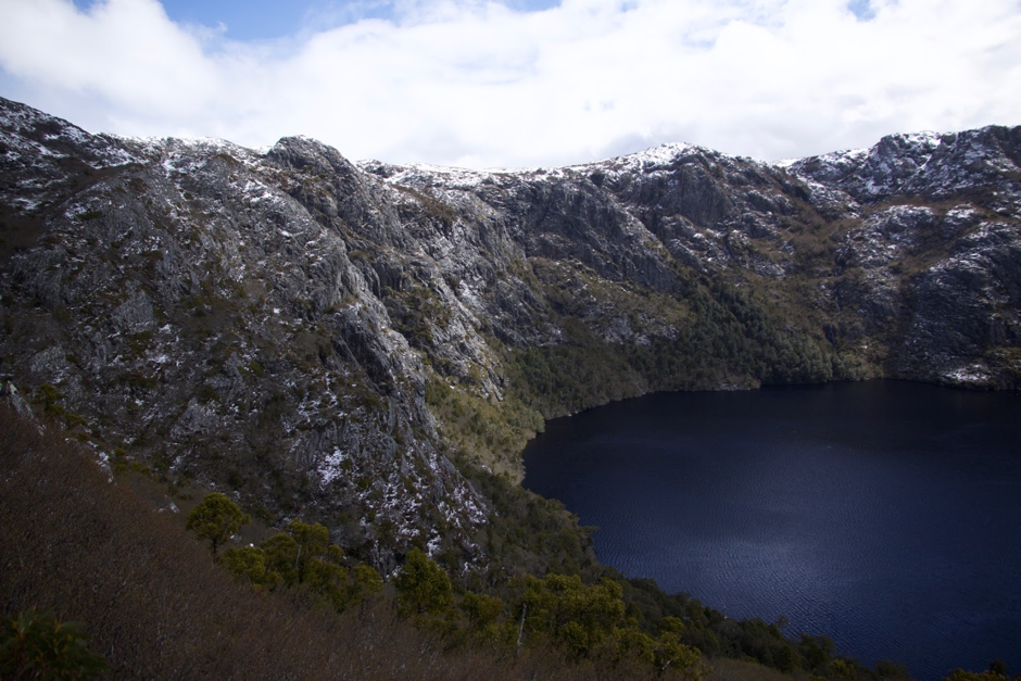
Fig. 3. Tassie lake wonderland. The topography of the Highlands is highly smoothed by the glacial exaration (the glacial destruction of the rocks).
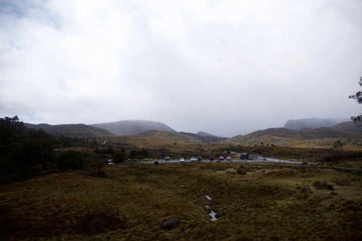
Fig. 4. Hummocky moraine terrain of the Cradle mountain-Lake St. Clair National Park. Area is mapped by (Derbyshire, 1968).
The term hummocky moraine is referring to an area of undulating landscape in which a disordered assemblage of knolls, mounds, or ridges of glacial debris is interspersed with irregular depressions and pits (kettles) that are commonly undrained and may contain swamps or ponds. This topography may have been formed either along an active ice front or around masses of stagnant ice.
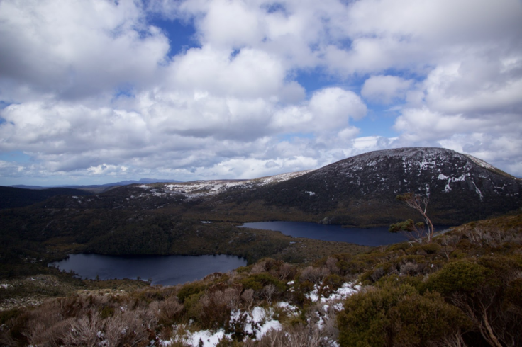
Fig. 5. Lake Lilla (left) and Dove Lake (right one) at the Cradle Mountain – Lake St. Clair National Park.

Fig. 6. Southern part of the Crater Lake. It is a tarn – the lake formed in a former glacier cirque (snow and glacier eroded amphitheatre-like valley, where the glacier begins).
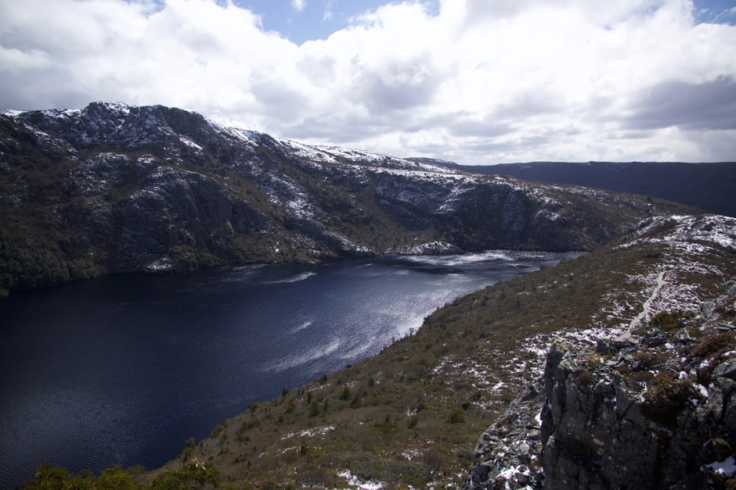
Fig. 7. View at the cirque threshold in the northern part of the Crater lake, where the glacier body flew down from the cirque.
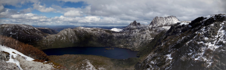
Fig. 8. View at the Cradle Mountain and the lake Dove from Marion’s Lookout. The spiky top of the mountain allows to call it nunatak – the mountain peak or ridge unaffected by glacial destruction.
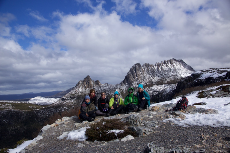
Fig. 9. By the way, we’d all been there! From left to right members of our crew: Johanna, Ilya, Perine, Suzette, Bethany, Anna. Hike to Marion’s Lookout from Ronny Creek is highly recommended (link to the national park brochure with hiking paths can be found in References)!
All the photos are taken by Anna Makushkina unless specified.
References:
Barrows, Timothy T, John O Stone, L. Keith Fifield, and Richard G Cresswell. “The Timing of the Last Glacial Maximum in Australia.” Quaternary Science Reviews, EPILOG, 21, no. 1–3 (January 2002): 159–73. doi:10.1016/S0277-3791(01)00109-3.
Colhoun, Eric A., David Hannan, and Kevin Kiernan. “Late Wisconsin Glaciation of Tasmania.” In Papers and Proceedings of the Royal Society of Tasmania, 130:33–45, 1996. http://eprints.utas.edu.au/10128/.
Colhoun, Eric A. “Quaternary Glaciations of Tasmania and Their Ages.” In Developments in Quaternary Sciences, edited by J. Ehlers and P. L. Gibbard, 2, Part C:353–60. Quaternary Glaciations Extent and ChronologyPart III: South America, Asia, Africa, Australasia, Antarctica. Elsevier, 2004. http://www.sciencedirect.com/science/article/pii/S1571086604801428.
Derbyshire E. “Glacial Map of N.W. – Central Tasmania.” Geological Survey Record No. 6. Tasmania. Department of Mines. 1968. http://www.mrt.tas.gov.au/mrtdoc/dominfo/download/GSREC06/GSREC06.pdf
Ehlers, Jürgen, and Philip L. Gibbard. “The Extent and Chronology of Cenozoic Global Glaciation.” Quaternary International, From the Swiss Alps to the Crimean Mountains – Alpine Quaternary stratigraphy in a European context, 164–165 (April 2007): 6–20. doi:10.1016/j.quaint.2006.10.008.
Hoffman, Paul F., and Zheng-Xiang Li. “A Palaeogeographic Context for Neoproterozoic Glaciation.” Palaeogeography, Palaeoclimatology, Palaeoecology 277, no. 3–4 (June 15, 2009): 158–72. doi:10.1016/j.palaeo.2009.03.013.
Visitor Information brochure: Cradle Mountain – Lake St. Claire National Park http://www.parks.tas.gov.au/file.aspx?id=34557


Leave a comment